
Peneda-Gerês National Park: pick a base and plan
Plan Peneda-Gerês with the right base, driving logistics, and official marked routes. Learn seasonality and protected-area rules before you go.
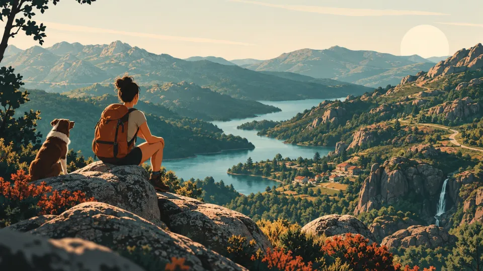
A smart base plan makes Gerês feel bigger, not harder
Most first-time visitors make one mistake in Peneda-Geres National Park: they pick a single “best viewpoint” instead of a base that shortens your driving and matches your walking style.
Peneda-Geres is a large protected area, with 69,592.50 hectares, stretching from Castro Laboreiro’s plateau area to the Mourela plateau area, and covering mountain ranges including Peneda, Soajo, Amarela, and Geres. (icnf.pt) That scale matters. Even on roads that look simple on the map, you can burn time on mountain turns.
Use this base framework instead:
- Choose by trail type: riverside and valley walks, high ridges, or mixed routes.
- Choose by access points: where you want to start each day’s loop (not where you want to sleep for one night).
- Choose by protected-area constraints: some activities are allowed only in specific contexts, and leaving marked routes can create legal and ecological risk.
Then ground your plan in official signage and route categories. In Peneda-Geres, you will commonly see GR (Grande Rota, long distance) and PR (Pequena Rota, shorter signed routes). The park also uses a national protected-areas signage system with standardized panels for guidance. (icnf.pt)
Finally, forget the “one perfect day” idea. Even the long GR route is broken into stages. For example, the GR 50, Grande Rota Peneda-Gerês, is about 190 km and split into stages across mountainous areas. (walkingpenedageres.pt) If you design your trip around stages, your walking becomes realistic, your driving becomes calmer, and your photos become easier to capture.
3 best base areas for first timers (and what each day feels like)
A strong base is a location where most of your daily movement fits one “loop logic.” For first-time visitors, three base styles usually work well in Peneda-Geres.
1) Terras de Bouro, for valleys, lakes, and day loops
If you want a base that feels like an easy on-ramp to multiple walking options, aim for the Terras de Bouro area. It gives you a valley-friendly start point for many itineraries, with day drives that tend to be shorter than bases deeper in the mountains.
2) Geres village, for the classic “heart of the park” feel
Staying around Vila do Gerês can reduce your friction if you want to do shorter walks, return for lunch, and keep your evenings simple. Many visitors pair this with marked trails that begin near the main access roads and then follow signed sections into the surrounding landscape.
A practical note: if you plan to camp or stay overnight with camping style logistics, check site rules before you rely on “nearby land.” Protected areas can be strict about off-site camping and fires, and you should assume that the “rules on paper” matter on the ground too. The ICNF guidance for protected areas explicitly advises contact with park services before allowed nature tourism activities, to avoid temporary bans or other restrictions. (icnf.pt)
3) Castro Laboreiro, for rugged mountain energy and long horizons
If you want the most “remote-feeling” atmosphere, base near Castro Laboreiro. It suits people who plan for longer, higher walks, and who do not mind that roads can be slow.
Quick base selection test (use this on a map)
Pick the base that lets you do these two things on most days:
- Start your walk within 45 to 75 minutes of driving.
- Return to the same base area for dinner, with a second shorter loop after lunch if you want.
This reduces risk because you will not be tempted by last-minute off-route “shortcuts.” When you stick to your planned loops, you also follow the principle behind marked route networks. ICNF and partner sources describe existing marked routes in the park territory (including GR and PR networks) rather than encouraging ad hoc travel. (resources.natural.pt)
Driving logistics that stop you from losing half a day
Your Peneda-Geres road plan should be boring on purpose. If your driving is predictable, your walking gets better, and your decision-making stays calm when weather changes.
1) Use “arrival windows,” not “arrive anytime” goals
Plan day arrival like a schedule:
- Arrive early at your main trailhead area so you can park once.
- If you are doing a longer route stage, build in time for slow sections. GR routes can involve uneven terrain, so the “walking distance” is not the same as “time on feet.” The GR 50 is about 190 km split into stages, which is a good reminder to stage your day planning. (walkingpenedageres.pt)
2) Avoid the common car mistake: chasing the photo spot
Many viral photos come from viewpoint areas that are near fragile habitat and protected zones. The safest approach is simple: park in permitted areas, then follow the marked trail network.
There is official planning language behind these limits. The consolidated Plano de Ordenamento do Parque Nacional da Peneda-Gerês includes restrictions such as limitations on activities like fishing and other actions in protected regimes. (diariodarepublica.pt) Even where you see activity nearby, the legal status can differ by zone.
3) Know that some “new paths” are not automatically okay
A specific document about existing signed pedestrian routes in the park territory (October 2024) is evidence that the park has a defined, curated set of routes and statuses. (resources.natural.pt) If a trail is not in that network, assume you may be walking into a land-use regime that is not meant for casual foot traffic.
4) If you must switch plans, switch to routes, not terrain
When you realize you cannot do the original hike, choose another marked option from the park route set or a PR/GR stage instead of “finding an easier way down.”
5) A mini checklist for each driving day
- Park once at a permitted spot.
- Start walking from a signed junction.
- Photograph only from stable positions on or beside the trail.
- Finish at the planned endpoint, then drive back.
This keeps you out of the two biggest first-time problems: getting stuck without a safe parking plan, and ending your day with an unplanned off-trail descent.
Official marked routes: use GR and PR like building blocks
The easiest way to travel confidently inside Peneda-Geres is to treat marked routes as your navigation backbone, not as “suggestions.”
Understand the route alphabet (GR vs PR)
In Portugal’s long-distance walking network, GR routes are long routes with consistent waymarking, while PR routes are smaller loops or shorter routes. In Peneda-Geres, you may also see the route network presented alongside route colors and legends in regional protected-area documentation. (adere-pg.pt)
One major example is the GR 50, Grande Rota Peneda-Gerês. It runs across multiple mountain areas and is about 190 km, split into 19 stages. (walkingpenedageres.pt) That stage concept is what you should copy: do one to three stages depending on your fitness and daylight.
Use a verified list of signed pedestrian routes
A research-focused document published in October 2024 lists signed pedestrian routes existing in the territory of the PNPG and their promoting entities. (resources.natural.pt) This helps you avoid the misconception that any path you find online is automatically official.
What official signage should look like
ICNF describes a national signage network for protected areas, including panel types intended for information and guidance on pedestrian routes. (icnf.pt) If you follow signage correctly, you reduce navigation errors that lead to off-route wandering.
A safe route planning method you can apply today
Use this 3-step method when choosing your hikes:
- Pick your trail category: GR for a multi-stage adventure, PR for shorter loops.
- Match day length to stage length: select a stage concept, not only a distance.
- Back up your choice: choose one “primary route” and one “Plan B route” that also uses marked waymarking.
Concrete first-timer idea (no risk, just structure)
- Day 1: choose a PR-style loop near your base.
- Day 2: do a single GR stage segment concept (do not attempt the whole GR 50).
- Day 3: repeat with a different valley or ridge segment, then rest.
This gives you the feel of Peneda-Geres without pushing into the most mistake-prone behavior, which is trying to “complete everything” with last-minute detours.
Seasonality and what changes in spring, summer, and autumn
Peneda-Geres changes fast across seasons, so the best “first visit” plan depends on when you go.
Spring: easier water and greener slopes, but still changeable days
In spring, you often get strong greenery and flowing streams. The trap is sudden wet ground. Even if you do not expect storms, trails can get muddy after rain.
Seasonal variation also affects wildlife disturbance risk. The park’s planning framework includes habitat-protection principles, and it restricts certain activities or actions in protected regimes. (diariodarepublica.pt) Your practical move is simple: stick to marked trails and avoid trampling vegetation off-path.
Summer: longer daylight, more visitors, more “temptations”
Summer brings longer daylight and increased crowding at popular water areas. This is where people drift off trails for “better angles” and then get stuck on unstable ground.
Also remember that rules around water-related use can depend on zone. For example, protected planning language covers fishing limits by zones, including that fishing is only allowed in reserved fishing zones and concessions in the park planning regime. (diariodarepublica.pt) This is not the same thing as swimming rules, but it is a reminder that the park treats water areas as managed, not open-ended.
Autumn: good walking light, but shorter days
Autumn often gives you comfortable walking temperatures and dramatic color. The risk is that daylight fades sooner, especially if your hikes include climbs.
A simple seasonal schedule template
No matter the month, use this structure:
- Morning walk: longer distance.
- Midday break: return near your base.
- Late afternoon walk: shorter, lower-intensity loop.
This avoids the common first-time error: “We will do the big route at noon.” In mountain terrain, you want your energy early, not late.
Protected-area rule of thumb by season
If you notice signage, temporary closures, or instruction boards, treat them as real time conditions. ICNF explicitly recommends contacting park services to ensure there are no temporary prohibitions that could affect allowed nature tourism activities. (icnf.pt)
Seasonality is not only weather. It is also when habitats are most sensitive and when authorities enforce rules more strictly.
Protected-area rules that affect everyday visitor choices
You do not need to memorize law to visit Peneda-Geres responsibly. You do need a short list of rules that drive real-world decisions.
1) Camping and overnight behavior can be restricted
One common misconception is that “camping anywhere in the mountains” is tolerated. Protected planning documents and protected-area guidance can prohibit camping outside designated locations.
For example, protected-area text includes the concept that camping or caravaning outside designated sites and overnight stays outside authorized conditions are not allowed. (icnf.pt)
Practical move: if you plan any overnight outside a standard hotel or registered campsite, verify the authorized options first.
2) Fires and fuel behavior can be limited
Even when people think they are being discreet, fires can be a legal issue and a safety issue. Camping management rules in the Geres area include explicit bans on making fires outside permitted areas. (turismoruraleparquesdecampismogeres.com)
Practical move: bring a plan that does not require open flame.
3) Some activities are limited by zone, including water use
The park’s planning regime includes restrictions that vary by protected zones. For instance, fishing is limited to reserved fishing zones and concessions. (diariodarepublica.pt) Another planning layer covers actions around sensitive areas and water bodies.
Practical move: when an activity is unclear, do not guess. Follow posted rules and official guidance.
4) Off-trail travel can put you into a different protection regime
A strong evidence point is that the park network of signed routes exists because routes have defined statuses and relationships to management plans. (resources.natural.pt)
Practical move: do not treat “a faint path” as permission.
5) Documentary proof you can use while planning
Use official sources when your plan depends on rules:
- ICNF pages for the park and protected areas, including facts on the park’s protected status and size. (icnf.pt)
- Official or consolidated planning documents for restrictions. (diariodarepublica.pt)
- Route listings that reflect authorized and signed networks. (resources.natural.pt)
The no-drama visitor checklist
Before you start a day’s walk, confirm:
- You are on a signed trail.
- You are not planning camping outside authorized sites.
- You are not planning fires outside permitted areas.
- You do not plan any off-trail shortcut.
This is the fastest way to respect the park while still getting the experience you came for.
Driving versus train: how to arrive without stress
If you are starting from Porto or Lisbon, you can build a low-stress arrival plan with trains, then finish with a local connection.
The main rail operator and where it fits
Portugal’s rail network is operated by CP, Comboios de Portugal. (gov.pt) If you are traveling toward northern cities that can connect to the Geres region, rail helps you avoid mountain driving fatigue on day one.
Use CP schedules and fare pages as your evidence, not guesses
CP provides train timetable PDFs and regional service information. (www2.cp.pt) For pricing and planning, CP also publishes fare information for key corridors such as Lisbon to Porto and onward connections that include Braga and Guimarães and connections toward Valença. (cp.pt)
Accessibility and customer support
If your plan depends on a specific station stop or transfer, use CP support channels. CP publishes customer care information as a starting point for passenger help. (cp.pt)
A practical hybrid plan that works for many travelers
- Take the train to a major hub like Porto or Braga.
- Use a local bus, taxi, or rental car for the final mountainous transfer.
- Keep your day plan route-based, not timetable-based.
Why this matters inside Peneda-Geres
Peneda-Geres is a large area, so arrival timing affects whether you can start walking early. Sticking to marked routes and returning to your base requires a reliable arrival window.
Common misconception to avoid
A common first-time mistake is assuming that public transport will drop you close enough to every trailhead without a plan. Build your trip around one base and one daily corridor.
One evidence-based planning tip
Treat your transfer like a “logistics block”: plan the rail to arrive before your walking block begins. Then confirm the second leg using official timetables and contact points, instead of relying on informal guidance.
This approach keeps your trip from collapsing when a local connection is delayed or when road access takes longer than expected.
A 3-day Peneda-Geres itinerary built on route logic (not hype)
This itinerary design uses a base-first, route-first logic. It avoids off-trail shortcuts and it builds your days around marked route categories.
Day 1: Base walk, learn signage, and set your pace
Morning
- Start with a shorter PR-style loop from your base area.
- Your goal is not “distance,” it is to practice staying on waymarked sections.
Midday
- Return for lunch and a rest break.
Late afternoon
- Do a second, shorter loop that stays within the same general valley or access corridor.
Why this day works: it lets you learn the rhythm of the park without overcommitting. ICNF’s protected-area signage system exists so you can navigate using recognized panels intended for pedestrian routes. (icnf.pt)
Day 2: One GR stage concept, then celebrate with a calmer evening
Morning
- Pick one stage concept from GR 50 (Grande Rota Peneda-Gerês) rather than trying to do “a piece of everything.” The GR 50 has about 190 km total and is divided into 19 stages. (walkingpenedageres.pt)
Midday
- Use the stage midpoint as your lunch planning point.
Evening
- Keep it local near your base.
Day 3: Switch landscape, repeat a PR loop, then do a final viewpoint check
Morning
- Choose a PR loop or a different access corridor trail.
- Aim for a loop that complements your Day 2 terrain (valley versus ridge).
Afternoon
- If you want “water views,” treat them as viewpoint stops from stable and permitted areas.
Protected-area decision rules built into this itinerary
- No off-trail shortcuts.
- No guesswork about where camping or fires might be allowed.
- When rules are unclear, follow official guidance and contact park services. ICNF recommends contacting park services to check whether there are temporary prohibitions that could affect allowed nature tourism activities. (icnf.pt)
Common first-time mistake this itinerary avoids
People often try to do the big route on Day 1. Instead, you earn navigation confidence on Day 1, and you spend your most demanding day on Day 2 after you are already oriented.
That is how you get better photos, better walking, and fewer logistics surprises.
FAQ: Peneda-Gerês planning answers for first-time visitors
What is the GR 50 in Peneda-Geres, and how long is it?
The GR 50, Grande Rota Peneda-Gerês, is a long-distance walking route that runs through mountain areas including Castro Laboreiro, the Peneda, Soajo, Amarela, and Geres ranges, and the Mourela plateau. It is about 190 km and divided into 19 stages. (walkingpenedageres.pt)
How do I find official marked trails in the park?
Look for route lists that reflect signed pedestrian routes existing in the PNPG territory. A document published for October 2024 lists signed routes and their promoting entities. (resources.natural.pt) Also follow waymarking designed for protected areas, described by ICNF as part of a national protected-areas signage approach. (icnf.pt)
Is off-trail hiking ever allowed in Peneda-Geres?
Assume it is not a safe default. The park is managed with zone-based protection regimes, and the existence of an official signed route network is evidence that travel is controlled through recognized paths. (resources.natural.pt) When you want to do something different, verify with official planning guidance or park services rather than guessing.
Can I camp wherever I want in the park?
No, do not assume it is allowed. Protected-area guidance includes prohibitions on camping or caravaning outside designated sites and on overnight stays outside authorized conditions. (icnf.pt) Use authorized accommodation and, if considering anything non-standard, verify first.
Are fires allowed while visiting?
Do not rely on informal permission. Camping area rules for Geres state it is forbidden to make fires outside permitted areas. (turismoruraleparquesdecampismogeres.com) If you need cooking, plan a no-open-flame option.
Can I fish anywhere I find water?
Fishing is limited by zone. The park planning framework states that fishing can be exercised only in reserved fishing zones and in fishing concessions. (diariodarepublica.pt)
How do I plan logistics if I do not want all driving time to be on day one?
Use CP for the rail leg, then handle the mountainous final access with a second transport block. CP publishes customer and service information and provides timetable resources for passengers. (cp.pt)
What is the best way to avoid temporary restrictions?
Before doing allowed nature tourism activities, ICNF recommends contacting park services to confirm there are no temporary bans or other restrictions. (icnf.pt)
If you want, tell me your arrival city, your travel month, and whether you prefer short PR loops or long GR stages, and I will suggest a day-by-day plan that stays fully within marked routes and verified rules.
Before you go: your exact next steps for a smooth Peneda-Geres visit
You can turn Peneda-Geres from a “big unknown” into a trip with clear decisions.
-
Pick your base using route logic Choose one base area that minimizes your daily driving time and fits one main trail corridor per day. Peneda-Geres covers a huge protected landscape, so a base choice affects everything else. (icnf.pt)
-
Choose routes from the signed network Pick at least two trail options before you arrive: one primary route and one Plan B. Use verified evidence sources, like the October 2024 list of signed pedestrian routes in PNPG territory. (resources.natural.pt)
-
Stage your walking, especially if you touch the GR 50 Remember the GR 50 is about 190 km across 19 stages. (walkingpenedageres.pt) Do not try to “sample the whole thing” in one day.
-
Respect protected-area rules that affect everyday choices Treat camping, fires, and off-trail movement as restricted decisions, not casual ones. Protected-area guidance includes limits on camping outside authorized sites and overnight stays outside authorized conditions. (icnf.pt)
-
Check for temporary restrictions if your activities are time-sensitive ICNF recommends contacting park services to ensure there are no temporary prohibitions affecting allowed nature tourism activities. (icnf.pt)
One thing you can do today
Open your map and write down a two-route draft for each day using marked PR or GR options, then match each route draft to one base-side access window (morning start, midday break, late afternoon loop). This one action locks in the driving logistics and reduces the temptation to improvise off-trail.
Related guides
Alentejo Beaches: Pick a Base and Plan Beach Days
Alentejo beaches, choose the right coastal base for your pace. Compare Odemira to Tróia and plan beach days with protected-area access rules.

Best Beach Towns in Portugal: Pick the Right Base
Compare Portugal beach towns as overnight bases. Learn transport links, town facilities, and beach setting, so you choose the right stay for your style.

Lagos or Albufeira: choose your Algarve base
Lagos or Albufeira: choose your Algarve base. Compare Old Town vs Oura, nightlife, family comfort, and practical travel logistics for car-free trips.
Where to stay in Madeira: base with or without a car
Where to stay in Madeira: choose a base with or without a car. Compare Funchal/Lido, Caniço, south and north options, plus a car-free plan.