
Sete Cidades on São Miguel: Viewpoints, Village & Day Plan
Sete Cidades on São Miguel, Portugal: official viewpoint stops, the best short walks, village tips, and a practical day plan with weather alternatives and transport options.

Fog can erase the “postcard” view, so plan for two outcomes in Sete Cidades
The most common Sete Cidades mistake is treating it like a single viewpoint with one guaranteed scene. In reality, the caldera rim, the lakeside village, and the higher trails can behave very differently within the same hour. You can start with clear visibility at one miradouro and end up in low cloud only a short distance away.
Treat the day as a set of “photography zones” you can swap based on conditions. For Sete Cidades, the official trail system helps you do this because you can switch between rim viewpoints and walks that still give you texture, color, and scale even when the far horizon is hidden.
A simple decision framework for you:
- If the rim is clear: prioritize the classic lake panoramas and a downhill walk that ends inside the village.
- If the rim is foggy: use lower viewpoints and the village waterfront edges first, then choose one shorter official walk loop.
- If it is wet or windy: keep your route on marked tracks and avoid exposed ridges. Waterproof layers and grippy shoes matter.
To support “official and open” choices, use the Azores official trail platform and the Parque Natural do Açores pages, which list trail codes and route guidance. For example, PR3 SMI is the official “Vista do Rei - Sete Cidades” walking trail, and its route description explicitly shows it starts at Vista do Rei viewpoint and ends inside Sete Cidades village. (turismo.azores.gov.pt)
Finally, never promise visibility. Even on the same day, fog and low clouds can move fast through the caldera. Your best protection is an adaptable plan plus official walking routes that keep you on safe, marked access corridors.
Choose viewpoints by height: rim panoramas vs lakeside details in Sete Cidades
Sete Cidades viewpoints feel like “one attraction” until you realize they sit on different levels of the caldera. That height difference changes what you see: the color separation of the lakes, the village geometry, and the outer western coastline perspective.
Here is a practical way to pick stops, using viewpoint types you can compare:
1) Rim panoramas (highest impact, highest chance of fog)
The classic starting point for many walkers is Miradouro da Vista do Rei. It is the trail start for PR03SMI Vista do Rei - Sete Cidades, a linear route that takes you from the rim viewpoint down into the village. (turismo.azores.gov.pt)
Because it is a rim viewpoint, visibility risk is real. Use it early and be ready to pivot if conditions worsen.
2) Mid caldera viewpoints (best compromise when the weather is mixed)
A good “in-between” stop is Miradouro da Lagoa de Santiago, which overlooks Lagoa de Santiago and sits on the descent to Sete Cidades. The official tourism entry places it on EN 9-1. (turismo.azores.gov.pt)
If the top is capped with cloud, mid viewpoints can still show lake texture, shoreline shape, and the steep caldera walls.
3) Village edge and lake detail (most reliable in low visibility)
When fog arrives, the village area still gives you strong subjects: shoreline curves, dock edges, and water color variation close to you. That is also where your official walking route can land.
PR03SMI is useful here because its official description says it ends inside the village. (turismo.azores.gov.pt)
4) Lakeside viewpoint logic for photographers
A misconception is that you need maximum distance to get a good image. In Sete Cidades, if the far horizon is hidden, you can still shoot:
- the contrast between blue and green lake water from slightly different angles
- wet rock and grass texture on the rim approach
- scale cues like the bridge separation of the lagoons
If you want a “single stop” with iconic coverage, Vista do Rei is the anchor. If you want resilience, Lagoa de Santiago viewpoint plus village edges give you better odds of seeing something worthwhile even when the sky closes in.
If you are planning for walking, keep your viewpoint order aligned with the direction of an official trail, so you reduce backtracking and time loss.
Pick the right official walking route: PR03SMI and PR04SMI are made for a day
For a single day in Sete Cidades, you need official routes that match your time budget and walking style. Two of the most practical are:
- PR03SMI Vista do Rei - Sete Cidades (rim to village)
- PR04SMI Mata do Canário - Sete Cidades (highlands to village via the Blue Lake corridor)
PR03SMI, the “rim to village” descent walk
The official tourism entry describes PR03SMI as starting at Vista do Rei viewpoint, moving through the southwest slope of the Sete Cidades ridges, and ending inside Sete Cidades village. (turismo.azores.gov.pt)
This is ideal if you want your morning to be the panoramic moment, then your afternoon to be calmer, more local, and less about elevation gains.
A key practical insight: because it ends in the village, you can pair it with lakeside stops and food without needing to “return to the same parking lot” mindset. The linear design is part of the value proposition.
PR04SMI, the “Blue Lake” approach walk
For variety, PR04SMI Mata do Canário - Sete Cidades is an official trail that connects the highlands near Mata do Canário to the Sete Cidades area and links with PR03SMI at a fork. (trails.visitazores.com)
The official PR04SMI flyer includes concrete details: it lists distance 11.8 km and an estimated time of about 3 hours, with medium difficulty. (trails.visitazores.com)
That matters for planning because you can build a day around it if you start early, or you can choose a shorter “partial day” approach if you treat it as an out-and-back segment (while still staying on marked trail).
A note on access and rules, use marked paths only
Sete Cidades sits within protected-area rules. One common mistake is wandering off-track to get an angle. In the Azores trail guidance platform, the emphasis is on knowing which trails are open and following existing paths. For example, the official Rota Vicentina help guide stresses the rule of not circulating outside existing paths (dirt roads) where it is forbidden. (rotavicentina.com)
Even though that specific guideline is for Rota Vicentina, the principle is consistent across protected landscapes: stick to signposted, official routes.
How to check “open vs closed” before you go
Do not rely on last year’s blog posts. Use the official alerts page in the Azores trail system, which lists closed trails in São Miguel. (trails.visitazores.com)
Then cross-check the specific trail you plan to walk by its code (PR03SMI or PR04SMI).
Your best workflow for a self-guided day:
- Check Azores Trails alerts for closures on São Miguel. (trails.visitazores.com)
- Choose one main trail (PR03SMI or PR04SMI).
- Add one short viewpoint stop near your route direction.
- Build your meal timing around the trail ending point in Sete Cidades village.
This keeps the day efficient and reduces the chance you will waste half a day trying to fix an access problem.
Build a practical Sete Cidades day plan with two weather branches
A great Sete Cidades day plan does not assume one kind of weather. Build two branches and commit to the one that matches what you see when you start.
Below is a day plan designed for you to keep movement simple, walk on official routes, and still enjoy the village.
Branch A: Clear or partly clear rim (classic “rim to village” day)
Goal: Vista panoramas first, then a descent walk, then village time.
1) 08:00 to 09:30, start at Vista do Rei viewpoint
Start your day at Miradouro da Vista do Rei. This is not just a viewpoint stop, it is also the start point for PR03SMI Vista do Rei - Sete Cidades. (turismo.azores.gov.pt)
Practical tip for photography and film work: shoot wide first, then do a second pass with slower frames once you have adjusted exposure to the water colors.
2) 09:30 to 11:30, walk PR03SMI down to Sete Cidades village
PR03SMI is a linear descent walk that ends inside the village. The official trail description confirms this “inside the village” ending. (turismo.azores.gov.pt)
Move at a steady pace. If visibility drops during the descent, you can still capture details like vegetation edges and caldera contour lines.
3) 11:30 to 13:30, lakeside viewpoint stops and lunch in the village
Pick one lakeside viewpoint stop near the areas you naturally pass, then eat in Sete Cidades village.
Add this specific midpoint if conditions are variable:
- Miradouro da Lagoa de Santiago on EN 9-1 gives you a lake-focused perspective. (turismo.azores.gov.pt)
Lunch anchor approach: choose a lunch spot after you have done your village orientation. You will avoid the “eat first, then walk lost” trap.
4) 14:00 to 16:00, short return walk (optional) or a second viewpoint
If you still feel strong, choose a short official walk segment linked to the village side, rather than starting a long new hike.
Keep it simple: the earlier you commit to PR03SMI, the less your afternoon needs extra distance.
Branch B: Rim foggy or low cloud (swap to village-focused route)
Goal: still get official walking, but prioritize areas where visibility is more stable.
1) 08:30 to 10:00, Lagoa de Santiago viewpoint and village orientation
Start lower with Miradouro da Lagoa de Santiago, since it sits on the descent toward Sete Cidades and overlooks the lake. (turismo.azores.gov.pt)
Then walk the village edge slowly. When fog blocks distant horizons, the best images often come from near subjects.
2) 10:00 to 13:30, do PR04SMI as a partial-day segment OR choose a connected official stop
If you want more “movement,” PR04SMI Mata do Canário - Sete Cidades provides an official high-to-village corridor. The official PR04SMI flyer lists 11.8 km and about 3 hours for the full experience at medium difficulty. (trails.visitazores.com)
In fog, you can adjust by doing a partial segment and turning around rather than forcing a full completion when the day becomes low-visibility.
3) 13:30 to 16:00, lunch and a shorter viewpoint loop
Return to the village for lunch and keep your last stop close. If you try to chase the rim at the end of the day, you risk repeating the same fog outcome.
Closure checks you should do before you commit
Right before leaving your accommodation, check the Azores Trails alerts page for São Miguel closed trails. (trails.visitazores.com)
If your main trail shows up as closed, do not attempt it anyway. Swap to a shorter segment and keep to open routes only.
Transport options: car, taxi drop-offs, and how to reduce backtracking
In Sete Cidades, transport is not just about getting there. It is about avoiding time loss from narrow roads, slow curves, and the need to return to the starting parking point.
Here are transport choices that fit how the official trails are designed.
Option 1: Hire car for flexible viewpoint hopping
A car gives you the simplest path planning because you can match viewpoints to the direction of your chosen trail. PR03SMI starts at Vista do Rei viewpoint and ends inside Sete Cidades village. (turismo.azores.gov.pt)
That means you can structure the day as “park near the start, walk to the village, then drive to any final close-by stop.”
Practical tip: when you plan, decide where you want to end your day. If you end in the village, you reduce your afternoon driving.
Option 2: Taxi or pre-arranged drop-off for one-way walking
If you do not want to drive at all, a practical strategy is a one-way walking route with a drop-off at the start viewpoint and pickup in the village. Because PR03SMI ends inside the village, it is naturally compatible with this approach. (turismo.azores.gov.pt)
I cannot promise taxi schedules or availability, but the structure of the walk itself is built for reducing returns to the same spot.
Option 3: Public transport, plan for fewer swaps
Public transport can work for reaching Sete Cidades, but for a day that includes multiple viewpoints, it can reduce your ability to pivot when weather changes.
Because this guide is about “viewpoints vs village” and weather alternatives, your best public-transport approach is to treat Sete Cidades as one main destination block, not a sequence of frequent location changes.
The backtracking test
Before you finalize your route, ask this question:
- Can I end my movement near where I want lunch and then where I want my final viewpoint?
For PR03SMI, the answer is often yes because the trail ends inside Sete Cidades village. (turismo.azores.gov.pt)
For PR04SMI, the full route is longer (11.8 km, about 3 hours). (trails.visitazores.com)
So if you use PR04SMI, either start early or treat it as a partial day plan so you still have time for village food and a close viewpoint.
A weather pivot that transport can support
When conditions turn, you do not need to abandon the day. If the rim is capped, prioritize Lagoa de Santiago viewpoint and village time, and delay or skip Vista do Rei if visibility is clearly poor. Lagoa de Santiago viewpoint is on the descent to Sete Cidades via EN 9-1, so it fits naturally into a lower-visibility branch. (turismo.azores.gov.pt)
The transport implication is simple: keep your fallback stops close to the village core so you can switch quickly.
Official route safety: what to do before you walk and what to avoid
Sete Cidades hiking is beautiful, but the island’s mountain weather can shift quickly. Your safety checklist needs to be about decision quality, not luck.
Step 1: Confirm the trail is open that day
Use the Azores Trails alerts page to check for closed trails in São Miguel. (trails.visitazores.com)
This matters because conditions, land management, or temporary restrictions can affect access. If a trail is listed under closed trails, do not attempt it.
Step 2: Use official trail codes, not only popular names
People often search “Vista do Rei hike” or “Mata do Canário trail,” then mix routes. Use the code system:
- PR03SMI for Vista do Rei - Sete Cidades (turismo.azores.gov.pt)
- PR04SMI for Mata do Canário - Sete Cidades (trails.visitazores.com)
When you check alerts and route notes, those codes help you avoid confusion.
Step 3: Match your time and energy to the official distance
The PR04SMI flyer gives you concrete planning numbers: 11.8 km and about 3 hours. (trails.visitazores.com)
If your day is tight, PR03SMI’s “rim to village” concept tends to be easier to fit because it ends in the village where you can stop. (turismo.azores.gov.pt)
Step 4: Stay on marked paths
A common misconception is that shortcuts exist and “nobody will mind.” In real protected landscapes, walking off the marked path can be unsafe, and it can also break conservation rules.
Even though the Rota Vicentina guide is separate, it clearly states a legal principle: it is not permitted to circulate outside existing paths in that area. (rotavicentina.com)
Use the same mindset in Sete Cidades: follow the signs and route markings, and do not cut across vegetation or climb down into unsafe slopes.
What to avoid in Sete Cidades
- Avoid exposed ridges when wind is strong. Fog plus gusts can make footing feel less stable.
- Do not rely on visibility for navigation. Use your map and trail markers.
- Avoid “one more viewpoint” if you are already wet and tired. You want safe, controlled movement.
A quick gear checklist
Carry:
- waterproof layer and a spare dry layer for your camera or phone
- grippy shoes suitable for wet ground
- water and a small snack
- a light hat or cap for wind-driven drizzle
This is practical advice aligned with official trail guidance style, which typically includes appropriate footwear and weather gear expectations on Azores trails. (parquesnaturais.azores.gov.pt)
If you do the open-check step first and keep movement on marked routes, you reduce uncertainty and make the day more enjoyable.
Sete Cidades village time: how to enjoy the “people and water” side
The village part of Sete Cidades is easy to treat as a rest stop. That is a missed opportunity. When you pace the day correctly, the village becomes your best “human scale” contrast to the big rim panoramas.
What the official walk gives you: a built-in village arrival
PR03SMI is described as ending inside Sete Cidades village. (turismo.azores.gov.pt)
That is useful because it turns “arriving somewhere” into an intentional transition. You go from ridge height to a street-level rhythm where you can slow down.
Village time plan you can repeat
After your walk, use this 60 to 120 minute block:
- Orientation loop: walk slowly along the lakeside edges to understand where the lagoons sit relative to the bridge and viewpoints.
- Photo reset: clean your lens, reframe, and switch from wide panoramas to calmer mid shots.
- Lunch with timing discipline: aim to eat when you are warm but before you lose daylight.
- One short viewpoint addition only: pick one extra stop, not five.
A misconception to avoid
Mistake: only photographing the lakes from the highest viewpoints.
Fix: include “water meets structure” shots from the village edge. Even in fog, these can hold up because they do not require distant horizons.
Where to position a viewpoint inside the village day
If you want an official stop that anchors your route and reduces guesswork, use a viewpoint that is clearly documented.
For example, Miradouro da Lagoa de Santiago is officially placed on EN 9-1 on the descent to Sete Cidades. (turismo.azores.gov.pt)
This makes it easy to insert without complex route re-planning.
Food and pacing note (no invented specifics)
You will find restaurants in the village and nearby areas, but opening hours can change. Use your day plan to avoid “arrive hungry, then search for a place.” Instead, decide your meal window based on when you finish your walk.
If your walk ends in the village, treat that as your lunch trigger.
Film and photography practical tip
When fog is present, you can still capture color separation in the lakes if you position yourself closer to the shoreline. The village edges give you more control over distance and framing.
In other words: make the village part of the composition, not just the pause button.
Weather alternatives that keep the day coherent: rim, mid, or village-first swaps
When the weather changes in Sete Cidades, your biggest risk is breaking the logic of your day plan. The best workaround is choosing a coherent alternative that still uses the same “layers” of the landscape.
Think of Sete Cidades as three layers:
- Rim layer: Vista do Rei and classic panoramas (high impact)
- Mid layer: Miradouro da Lagoa de Santiago (lake focused, more resilient)
- Village layer: Sete Cidades itself (human scale, close subjects)
Swap rule based on visibility
Use these swaps instead of random re-routing.
If the rim is invisible, start mid layer first
Start with Miradouro da Lagoa de Santiago. The official tourism entry places it on EN 9-1 on the descent to Sete Cidades. (turismo.azores.gov.pt)
Then move into the village.
If the mid layer is also foggy, commit to village-first walking
Stay in the village zone for a while and do one official walk segment that does not require extreme exposure.
If you want a longer “day movement” option, PR04SMI is a full 11.8 km route. (trails.visitazores.com)
In fog, plan to turn around earlier and preserve energy.
If the rim clears later, do one rim revisit only
Do not chase every rim viewpoint again. Pick one return to Vista do Rei if conditions open up, because it is also the start point of PR03SMI. (turismo.azores.gov.pt)
Swap rule based on rainfall or wind
- Rain: slow your pace, avoid steep slick descents, and keep your camera protected. Use official trails, not shortcuts.
- Wind: avoid exposed ridges and prioritize the mid and village layers.
Closure rule is separate from weather
A common misconception is “it is raining, so maybe it is closed.” Closures are not always weather-only. Use the Azores Trails alerts page for actual closed trails in São Miguel. (trails.visitazores.com)
Then pick an open route.
A single “anchor stop” you can always use
Miradouro da Lagoa de Santiago is a stable anchor because it is officially documented and located on the approach. (turismo.azores.gov.pt)
Even if you cannot get full rim panoramas, that stop gives you a meaningful lake subject and keeps your day coherent.
A quick planning checklist for your phone notes
Write this before you arrive:
- If Vista do Rei is foggy: go to Lagoa de Santiago viewpoint first. (turismo.azores.gov.pt)
- If you want a walk: choose PR03SMI or PR04SMI and adjust distance as needed. (turismo.azores.gov.pt)
- Always check alerts for closures on São Miguel. (trails.visitazores.com)
That is how you keep your day both beautiful and realistic.
A viewpoint plus walk pairing test that prevents wasted time in Sete Cidades
If you plan Sete Cidades as a list of independent stops, you will lose time to backtracking and you may walk harder than you intended. Use a pairing test instead.
The pairing test, a 2-question method
Before you commit to a viewpoint, ask:
- Is it aligned with an official walking route direction?
- Does the next stop reduce driving or reduce elevation churn?
This turns your day into a smooth chain.
Pairing example 1: Vista do Rei viewpoint plus PR03SMI
This is the cleanest match. Vista do Rei is the start of PR03SMI, and the trail description says it ends inside Sete Cidades village. (turismo.azores.gov.pt)
So you get:
- a panoramic viewpoint early
- an official descent walk
- a natural transition into village time
That is exactly the kind of pairing that reduces wasted time.
Pairing example 2: Lagoa de Santiago viewpoint plus village-first timing
Miradouro da Lagoa de Santiago is officially located on EN 9-1 on the descent to Sete Cidades. (turismo.azores.gov.pt)
So it fits as a lower-visibility anchor. Then your walk and meal can happen in the village without you needing to drive back to a high rim.
How to do the test for PR04SMI
PR04SMI is longer, with a full route listed at 11.8 km and about 3 hours. (trails.visitazores.com)
If you pair it with a rim viewpoint, start early and treat it as the main event. If you do it as a “bonus after sightseeing,” you risk running out of time.
Instead, use PR04SMI in a single coherent block and keep your additional stops minimal.
A practical mistake to avoid: “viewpoint hopping” after a long walk
When you finish a longer trail, your legs are tired. Fog and rain make footing unpredictable. The right adjustment is to choose one nearby viewpoint or none.
In Sete Cidades, the village already gives you a lot of visual variety, close-up water color, and human scale. Use that as your recovery moment.
Use official trail codes as your mental map
The pairing test works better when you anchor on trail codes:
- PR03SMI for a rim to village day (turismo.azores.gov.pt)
- PR04SMI for a longer highlands to village corridor (trails.visitazores.com)
Then you can decide viewpoint additions with confidence.
One quick template you can copy into your notes
- Start: Vista do Rei (or Lagoa de Santiago if rim is foggy). (turismo.azores.gov.pt)
- Walk: PR03SMI or PR04SMI, adjust distance if visibility is poor. (turismo.azores.gov.pt)
- Finish: Sete Cidades village for lunch and one short final stop.
That template makes your day predictable even when the sky is not.
Conclusion: your best next step is to lock one trail and one fallback viewpoint
You do not need perfect weather to enjoy Sete Cidades. You need a plan that can survive fog and drizzle, and you need to base walking on official, open routes.
Here are your actionable takeaways:
- Use official alerts first. Check the Azores Trails alerts page for São Miguel closed trails before you leave. (trails.visitazores.com)
- Choose one main walking route. If you want an efficient day, anchor on PR03SMI Vista do Rei - Sete Cidades, which starts at Vista do Rei viewpoint and ends inside Sete Cidades village. (turismo.azores.gov.pt)
- Have a fallback viewpoint with documentation. If the rim is capped, pivot to Miradouro da Lagoa de Santiago, located on EN 9-1 on the descent to Sete Cidades. (turismo.azores.gov.pt)
- If you pick PR04SMI, plan for the distance. The official PR04SMI flyer lists 11.8 km and about 3 hours for the full route. (trails.visitazores.com)
- Never promise visibility. Treat viewpoint order as a two-branch plan, not a single script.
What you can do today
Open your phone notes and write this exact checklist for your future self:
- “Check Azores Trails alerts for São Miguel.” (trails.visitazores.com)
- “Primary walk: PR03SMI Vista do Rei - Sete Cidades.” (turismo.azores.gov.pt)
- “Fallback viewpoint: Miradouro da Lagoa de Santiago on EN 9-1.” (turismo.azores.gov.pt)
- “If wind or fog worsens, shorten any long plan (do not force a full PR04SMI day).” (trails.visitazores.com)
Then decide one thing: your main walk. Once that is locked, everything else becomes easier to pace, and your day becomes more enjoyable even when the clouds move in.
Related guides
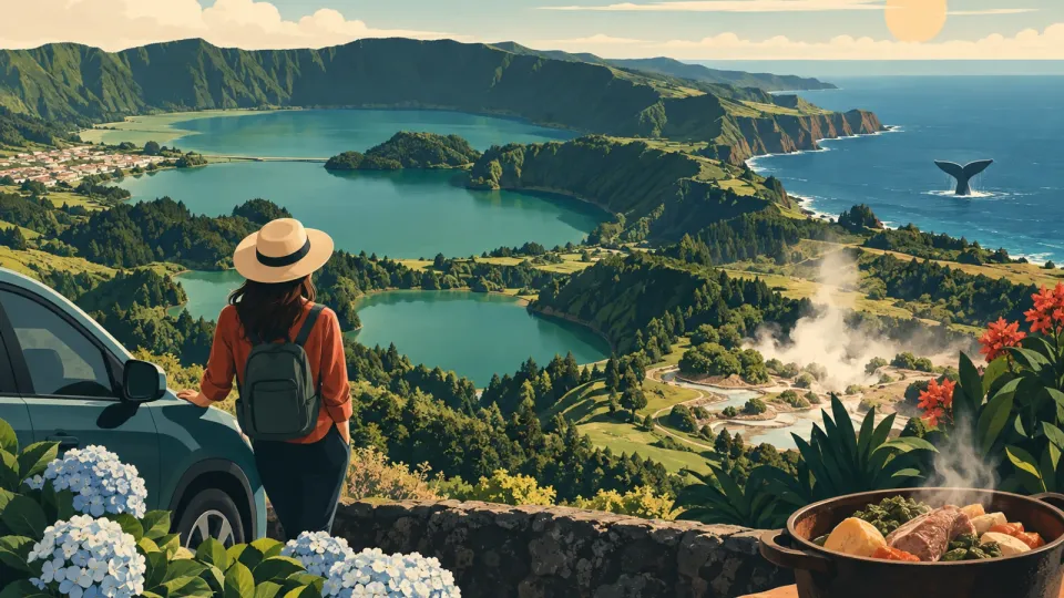
Sao Miguel Azores itinerary, 5 days the right way
sao miguel azores itinerary for 5 days: Sete Cidades, Furnas cozido, east side, and whale watching. Save time, drive smarter, book right.
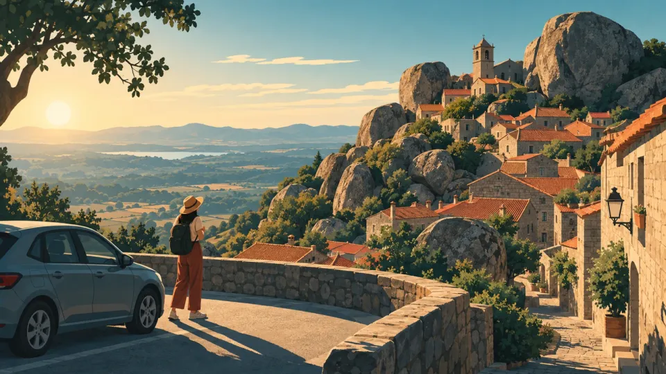
Monsanto Portugal Village Guide: Parking and Day Trip
Plan a Monsanto Portugal village visit without the usual stress: steep streets, where to park outside the core, and how to choose a day trip or overnight.

Flores Azores: waterfalls, viewpoints and weather buffers
Plan a resilient Flores trip focused on waterfalls and viewpoints, with smart weather buffers, swapping day options, and official trail and ferry checks.
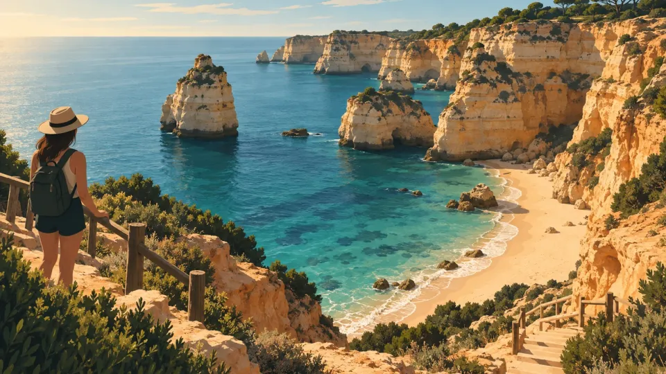
Praia da Marinha Guide: Steps, Access, Viewpoints
Praia da Marinha in Lagoa, Algarve, explained: how to reach the beach, what the cliff descent is like, and how viewpoint walks differ from sand access.