
Seven Hanging Valleys Trail in Lagoa, Portugal Route
Plan the Seven Hanging Valleys Trail coastal walk in Lagoa, Portugal. Get the official PR1 route, one-way logistics, restrictions, and heat tips.
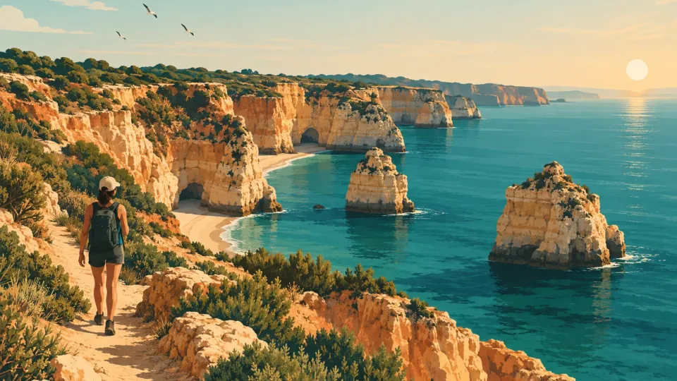
Why the “Seven Hanging Valleys” hike feels like a cliffside maze
The Seven Hanging Valleys Trail, in Portuguese Percurso dos Sete Vales Suspensos, is famous for a strange landscape effect. You hike along the limestone sea cliffs, and the “valleys” are the remains of old watercourses that once reached the ocean. Now those streams run above the sea, so each valley opening feels like a window carved out of the cliff.
You should plan for this as a coastal linear walk, not a circular stroll. The official trail links Praia da Marinha to Praia de Vale Centeanes. It is marked as PR (pequena rota), PR1 LGA, and it follows the coastline in one direction. If you want a round trip, you need transport or you need to return along the same marked alignment.
Here is a common misconception: people try to “wing it” by looking for cliff shortcuts to reach the next bay faster. The municipal guidance is explicit about avoiding shortcuts, and the official leaflet treats the shoreline as a risk zone where you should stay on the existing path.
What makes the walk feel vivid on foot is the rhythm of climbs and drops between valley cuts. You also get repeated sightlines over the Atlantic and the limestone texture of the Algarve’s arribas (cliffs). The trail passes viewpoints and protected stretches, so your pace matters. Slow down for photography, but do not stop where the path narrows.
Primary route evidence to use when planning:
- The trail is PR1 LGA (Percurso dos Sete Vales Suspensos) and is a linear PR on the Lagoa coastline between Praia da Marinha and Praia de Vale Centeanes (official PR leaflet PDF). You can also cross-check local municipal descriptions and route pages for the same endpoints. [Official PR1 LGA leaflet (PDF)]
If you only remember one planning fact: this hike is about managing logistics (start and finish points), not just picking a scenic day.
The official PR1 LGA route endpoints you must plan around
Your first decision is simple: choose your start, because the official PR1 LGA route is linear.
Start and end points (do not swap them)
- Start: Praia da Marinha (English commonly “Marinha Beach”)
- End: Praia de Vale Centeanes (English commonly “Vale Centeanes Beach”)
The PR1 LGA leaflet describes the itinerary as a linear PR and states the trail is marked in two directions by the nature of the PR system, meaning you can walk it either way. However, the itinerary is still one continuous corridor between those two beaches, not a loop. In other words, you should not expect a “return to your starting car” without planning. [Official PR1 LGA leaflet (PDF)]
Distance and how to read it
Different trail pages repeat slightly different numbers. For example, some sources summarize the distance as about 6 km one way and about 12 km round trip. The municipal-facing technical sheets also describe the walk as a round-trip experience. One published PDF trail listing describes 11.20 km ida e volta (return distance). [Junta de Freguesia de Porches, Percurso dos 7 Vales Suspensos]
To avoid planning mistakes, treat the following as your rule:
- Decide your direction first (Marinha to Centeanes, or Centeanes to Marinha).
- Plan for a walk that feels like a half-day coastal hike if you include photography stops.
- If you intend to return to the same starting point the same day, budget extra time and energy.
One-way versus return: what “works” logistically
Because the trail connects two beaches, you have three practical options:
- Option A: Walk one-way and arrange transport at the far end.
- Option B: Walk one-way, then turn back and retrace the PR along the same marked path.
- Option C: Use a point-to-point ride and walk only the direction you chose.
For transport realism, you do not need exact timetables in this guide, but you do need to know that there is a regional bus network in the Algarve (operator branded Vamus) that can stop near coastal areas around Lagoa and Carvoeiro. For example, official tourism content mentions Vamus routes and seasonal operating periods for nearby areas like Benagil. [Algarve Portugal Tourism (tourism site), Benagil cave page]]
The key takeaway: plan for endpoint logistics, not for “parking at one spot and walking a circle.”
Heat and marked-path guidance for a cliff-edge hike
The Seven Hanging Valleys Trail rewards early planning because the path is exposed. Sun, wind, and sudden cliff instability risks are not theoretical. The official PR leaflet and local guidance both emphasize staying on the marked trail and being cautious near unstable cliff edges.
Heat: the scheduling test that keeps you comfortable
A good rule for this coastline hike is to start when temperatures are lower and the light is still soft for photography.
Local guidance from the Porches parish page advises you to avoid very hot days and also to avoid windy or rainy days. [Junta de Freguesia de Porches, Percurso dos 7 Vales Suspensos]
Turn that into a simple plan:
- Pick a morning start if you can.
- Bring water and plan for small pauses rather than long stops.
- Wear sun protection, because the coastal line can have limited shade.
Marked-path guidance: what to do when you feel tempted
Two instructions matter most on this route:
- Use only the existing paths and tracks, avoid shortcuts.
- Do not treat the cliff edge like a photo platform.
The Porches parish guidance explicitly says: “Utilize apenas os caminhos e trilhos existentes, evite os atalhos” (use only existing paths and avoid shortcuts). [Junta de Freguesia de Porches, Percurso dos 7 Vales Suspensos]
The PR1 leaflet adds safety warnings about environmental factors like strong winds, ocean swell, rain, and loose stones, because they can increase risk of falls. [Official PR1 LGA leaflet (PDF)]
Practical heat and safety checklist (pack like a pro)
- Water: bring enough for the direction you choose (and add a buffer).
- Sun protection: hat or cap, sunscreen, sunglasses.
- Footwear: closed, grippy shoes. The route can include uneven ground and exposed rock.
- Clothing for wind: a light layer helps when coastal gusts rise.
- Do not linger near narrow edges: stop slightly back from the immediate cliff line.
Common mistake: “I’ll just cut to the next viewpoint”
On this trail, shortcuts can put you off the stable, designed foot corridor. The official and parish guidance repeat the same theme: stick to the marked path.
If you want a photography workflow, use this approach:
- Walk to the next wider lookout.
- Take your photos.
- Move on before the crowd pressure builds and before the light changes.
This way, you reduce time spent near the cliff edge and you keep your pace aligned with safety.
How to handle one-way planning without guessing at distances
The biggest planning trap for this hike is treating it like a normal day loop. It is not. Your choices must match your transport and your energy level.
Start with direction, then build your logistics
Choose one direction now:
- Marinha to Vale Centeanes, or
- Vale Centeanes to Marinha.
Both directions are consistent with the PR concept of a marked linear route, and official trail information describes the route as connecting those beaches. [Official PR1 LGA leaflet (PDF)]
Use “time blocks” instead of risky distance assumptions
Because different published summaries can vary slightly, avoid inventing exact distances or cliff access shortcuts. Instead, plan with time blocks.
A practical framework for coastal PR hikes:
- Approach block: the first valley-to-valley segment, where you get warmed up.
- Photo block: mid-walk lookouts where you slow down.
- Finish block: the last stretch before the end beach, where fatigue can make footing worse.
Then add buffer time for:
- water refills,
- bathroom breaks,
- and wind or sand that slows you down.
Three logistics models that work for self-planners
- Point-to-point ride (best if you want one walk only): arrange a taxi or ride drop at one endpoint and pick-up at the other.
- Public transport plus short hike connection: use the Algarve bus network to get close to one endpoint, then walk the PR segment.
- Out-and-back: walk one way, then return along the same marked corridor.
For public transport context, tourism pages describe seasonal operation and routes in the Lagoa and Carvoeiro area. For example, the Benagil tourism guide discusses Vamus service and its seasonal operating period between May 1 and Oct 31 on specific routes. That gives you a realistic sense that some services are seasonal, so you should check exact dates for your travel week. [Algarve Portugal Tourism (Benagil cave page)]
Endpoint realism: what to check before you commit
Before you leave, confirm:
- Where your chosen endpoint parking actually is (coastal areas fill up).
- How you will move from finish back to your base.
- Whether you need a ride arranged in advance.
If you want a low-stress plan, do this today:
- Pick your direction.
- Write down your transport plan for the finish point.
- Plan your walk speed as slower than you think, because the ground changes and the views invite pauses.
That is how you avoid the classic mistake: getting to the end beach and realizing the ride is not set.
Marked-path navigation: how to stay on PR1 without getting lost
Staying on the marked line is what turns a beautiful hike into an easy one. The good news is that PR routes in Portugal are designed to be identifiable on the ground. The key is to treat markers as instructions, not decorations.
Why you should follow the PR concept, not your phone map only
Coastal cliff routes can have confusing visual cues. You might see a tempting track down toward sand or a better looking route around a valley cut. But both official PR and local municipal guidance stress you should avoid shortcuts and stick to existing paths. [Junta de Freguesia de Porches guidance]
If you blend marker checking with your phone map, you get the best of both worlds:
- markers keep you on the safest approved alignment,
- your phone confirms you are moving in the right direction.
Use the leaflet as your “truth source”
The official PR1 LGA leaflet is designed for walkers and includes route information and safety notes. One of its most important safety sections warns about factors like wind, sea swell, rain, or loose stones on the cliff. [Official PR1 LGA leaflet (PDF)]
When you pack, add a screenshot of:
- the route name (Percurso dos Sete Vales Suspensos),
- the endpoint beaches (Praia da Marinha and Praia de Vale Centeanes),
- and any safety reminders.
Marker discipline: a simple rule
Whenever you lose a marker for more than a few steps, stop and re-check instead of “guessing.”
Turn that into a procedure:
- Keep walking, slowly, while looking for the next marker.
- If you do not see one within a short window, pause.
- Check your phone position and compare direction to the official route description.
- Continue only when you are confident you are still on the PR alignment.
Avoid the “cliff access shortcut” mindset
Tourism pages describe the landscape as a sequence of limestone features, coves, and valleys. That can make it feel like you should be able to reach water-level areas directly. But that is exactly where people get tempted to step off established paths.
The Porches parish page is clear on avoiding shortcuts and respecting the natural setting. [Junta de Freguesia de Porches guidance]
Heat and footing interact
On hot days, loose surfaces and sand can make footing worse near uneven rock edges. That means navigation discipline is also a safety tool.
One immediate improvement you can make: plan to use short photo sessions at confirmed lookouts, not extended stops while you search for “the next perfect angle.” That reduces the chance you wander away from the marker line.
Endpoint logistics for Lagoa and Carvoeiro: buses, taxis, and timing checks
Your hike does not end where the trail ends. It ends when you can reliably get from one beach endpoint to the other, or back to your base. That is the real “finish line” for self-planners.
What to plan for at the endpoints
Because the PR1 LGA trail connects Praia da Marinha to Praia de Vale Centeanes, you need a transport plan for at least one endpoint. [Official PR1 LGA leaflet (PDF)]
A smart approach:
- Decide whether you want a ride pickup at Vale Centeanes or a ride pickup at Marinha.
- Decide whether you will walk back (out-and-back) or truly do one-way.
Public transport reality in the Algarve: expect seasonality
Some coastal bus routes operate seasonally, and that can change your options. For example, tourism guidance for the Algarve notes that a Vamus route between Alvor and Armação de Pêra stops in Benagil and operates between May 1 and Oct 31. That is a clear signal that not every connection runs year-round. [Algarve Portugal Tourism (Benagil cave page)]
Even if your exact endpoints differ, the lesson stays the same: before you rely on buses, check the service status for your travel dates.
Taxi and ride planning: the low-effort safety net
If you do not want to manage bus schedules, a point-to-point ride plan is often the simplest. The advantage is control: you can start your hike early, you can finish when you want, and you are not waiting on a timetable.
If you choose this model:
- Confirm pickup availability in advance.
- Give the driver the endpoint beach names (Portuguese helps).
- Build buffer time for traffic around coastal areas.
A practical hybrid strategy
If you want both flexibility and reduced waiting, use a hybrid:
- Walk one direction as planned.
- Keep your phone ready for a ride request after you reach the finish.
- If the walk runs long due to wind or crowds, you are not stuck.
Common mistake: assuming endpoints have equal transport access
Some beach areas have more frequent connections than others, especially outside peak season. That is why you should plan your transport using a date-aware check.
One immediate action you can take today:
- Look up transport options for your exact travel dates for Lagoa and the coastal stops near Praia de Marinha and Praia de Vale Centeanes, then decide whether you will do a one-way walk with pickup or an out-and-back return.
This planning step prevents the frustrating outcome: a beautiful hike with no realistic way to leave the finish area.
Restrictions and risk management: what official sources warn you about
For this trail, restrictions are not just bureaucratic text. They reflect real hazards on an exposed cliff coastline. Treat official guidance as risk management for both you and the environment.
Stay on the marked paths, avoid shortcuts
The Porches parish trail page repeatedly points visitors to use only existing paths and to avoid shortcuts. It also gives general responsible behavior reminders like not damaging plants and disposing of rubbish properly. [Junta de Freguesia de Porches guidance]
That guidance is crucial on cliff routes because off-trail movement increases erosion and increases your personal risk.
Watch for conditions that increase cliff and ground risk
The official PR1 LGA leaflet includes specific warnings about conditions that can make the route dangerous. It highlights factors like strong winds, ocean swell, rain, and loose stones on the cliff edge area, because they can provoke falls. [Official PR1 LGA leaflet (PDF)]
This has an important planning implication:
- If the day forecast or on-site conditions suggest rough sea, strong wind, or rain, you should reassess whether you should go.
- Do not treat safety warnings as generic. They are part of the route design.
Park and coastal rules can exist alongside the PR
Some nearby coastal areas are governed by specific rules for use, including guidance about access, ecology, and visitor behavior. While the exact rules depend on the protected area boundary, it is still smart to assume you must follow local park usage policies, especially around fragile coastal habitats.
A related official-style document for a coastal park provides an example of visitor-use norms and restrictions that are meant to protect the environment. Use this only as a pattern for how coastal governance works, not as an exact replacement for the PR leaflet rules. [Example coastal park usage norms]
“Restrictions” that often show up as behavior, not gates
You may not find a physical gate on every segment. Instead, restrictions show up as:
- recommended avoidance of unsafe conditions,
- discouragement of shortcuts,
- and adherence to marked routes.
So your practical compliance is simple:
- Stay on the PR alignment.
- Turn around or reschedule if conditions worsen.
- Respect the natural setting, including plants and nesting areas where relevant.
Heat is a risk amplifier
Heat does not just make you uncomfortable. It can make you rush, and rushing is when people step wrong on uneven limestone rock.
The best mitigation is boring but effective: pace yourself, drink water, and slow down near narrower cliff edges.
Immediate next step:
- Before you commit to leaving, review the official PR safety notes on wind, swell, rain, and loose stones, then decide whether your conditions match those warnings. Your plan should include a fallback day.
A photography-first plan that still respects safety and flow
You can get great photos on this trail, without turning it into a risky detour. The trick is to build photography into your walking rhythm, not to replace the walking with wandering.
Use the “lookout cadence” method
The landscape is made of repeating features: valley cuts, limestone textures, and ocean views. That means you do not need to search for perfect shots everywhere.
Try this cadence:
- Walk to the next confirmed lookout or wider section.
- Spend 3 to 7 minutes shooting.
- Move on before your feet get tired or before the wind gusts become distracting.
This reduces time near the immediate cliff edge and it keeps you aligned with the marked-path discipline from local guidance. [Junta de Freguesia de Porches guidance]
Plan your direction to match light and progress
Because the trail is linear between Praia da Marinha and Praia de Vale Centeanes, your direction controls which side of the coastline you photograph from. [Official PR1 LGA leaflet (PDF)]
If you want a simple rule:
- Choose the direction that gives you consistent sightlines with the light you prefer.
- If you are unsure, pick whichever endpoint lets you start earlier in the day.
Bring a safety-aware kit
Photography gear adds weight, and on an uneven cliff path, that matters.
A balanced kit:
- compact tripod only if it is allowed and practical on the route sections you use,
- small flashlight or phone torch if you start late,
- water and sunscreen first, camera second.
Know when not to shoot
The official PR leaflet warns about conditions that increase risk, including strong winds, sea swell, rain, and loose stones. On those days, photography can become a reason people linger where they should move away. [Official PR1 LGA leaflet (PDF)]
So set a personal rule:
- If you feel the wind makes footing unstable or if waves feel rough, stop taking long exposure shots and prioritize moving steadily.
Avoid the “shortcut composition” trap
Some of the most dramatic angles tempt you to step off the safe corridor. Resist it. The Porches parish guidance explicitly advises avoiding shortcuts and using existing paths and trails. [Junta de Freguesia de Porches guidance]
One practical photo plan you can reuse
- Start at your chosen beach endpoint.
- Walk to the first wide valley opening.
- Shoot a short set, then keep moving.
- Repeat every time you reach a natural pause zone.
That approach creates variety, reduces wandering, and keeps you safe.
FAQ: route, restrictions, and how to plan your day in Lagoa
Is the Seven Hanging Valleys Trail a loop or a point-to-point walk?
It is a linear PR route. The official PR1 LGA trail connects Praia da Marinha to Praia de Vale Centeanes. Plan for one-way logistics or an out-and-back return, rather than expecting to finish at your starting point. [Official PR1 LGA leaflet (PDF)]
Can I walk it one-way or do I have to return the same way?
The trail is marked as a PR (pequena rota) linear route between those endpoints, and you can walk it either direction, depending on how you start. What matters is that you still need transport at the finish if you do a true one-way walk. [Official PR1 LGA leaflet (PDF)]
What are the main restrictions or safety warnings?
Official guidance warns about risks tied to strong winds, ocean swell, rain, and loose stones near the cliff areas. It also emphasizes staying on the route and not treating the cliff edges as safe areas to explore off the path. [Official PR1 LGA leaflet (PDF)]
How do I avoid getting lost on the marked trail?
Use the PR alignment as your primary route, because local guidance tells you to use only existing paths and trails and to avoid shortcuts. If you miss markers, pause to re-check instead of choosing an uncertain alternative path. [Junta de Freguesia de Porches guidance]
What should I do about heat?
Local guidance recommends avoiding very hot days and also avoiding days that are windy or rainy, because those conditions increase discomfort and can increase risk on an exposed coastline. Bring water and start earlier when possible. [Junta de Freguesia de Porches guidance]
Does public transport help with endpoints?
Public transport can help, but services may be seasonal. For example, tourism content for the area notes a Vamus route that runs between May 1 and Oct 31 for stops that include Benagil. Check the exact service for your travel dates before relying on buses for an endpoint connection. [Algarve Portugal Tourism, Benagil cave page]
What is the one mistake that ruins planning for this hike?
Assuming it is a circular trail. Because the PR1 LGA route connects Praia da Marinha to Praia de Vale Centeanes, you must plan your transport at one end or plan an out-and-back return.
Plan it today: a step-by-step coastal walk checklist
You can turn the Seven Hanging Valleys Trail into a confident plan in about 20 minutes. Start with the official endpoints, then lock your safety and transport decisions.
Step 1, confirm your route direction
Write down your chosen direction:
- Praia da Marinha to Praia de Vale Centeanes, or
- Praia de Vale Centeanes to Praia da Marinha.
The official PR1 LGA route connects those beaches as a linear coastal hike. [Official PR1 LGA leaflet (PDF)]
Step 2, choose one logistics model
Pick one:
- One-way with pickup at the finish.
- Out-and-back along the same marked PR path.
- Public transport only if you verify service for your dates.
For public transport, treat it as date-dependent. Tourism guidance shows that at least some nearby Vamus routes operate only between May 1 and Oct 31. [Algarve Portugal Tourism, Benagil cave page]]
Step 3, build a safety plan that matches official warnings
Before you leave, check conditions through your usual sources. Use the official PR safety prompts as your checklist:
- strong winds,
- sea swell,
- rain,
- loose stones.
If conditions look worse, change your plan instead of pushing forward. [Official PR1 LGA leaflet (PDF)]
Step 4, pack for heat and uneven coastal ground
Based on local guidance, avoid very hot days and bring the basics. [Junta de Freguesia de Porches guidance]
Pack:
- water,
- sun protection,
- closed footwear,
- a light layer for wind.
Step 5, plan your photo stops without leaving the trail
Use the lookout cadence method:
- shoot for a few minutes at wider sections,
- then move on.
And follow the local rule: avoid shortcuts and stick to existing paths. [Junta de Freguesia de Porches guidance]
One specific action you can do today
Open the official PR1 LGA leaflet and save it to your phone, then write the two endpoint names in Portuguese next to your transport plan: “Praia da Marinha” and “Praia de Vale Centeanes.” Use those exact names when arranging any ride or checking endpoint access.
Related guides

48 hours in Porto: a Lisbon resident’s working itinerary
48 hours in Porto itinerary that skips tourist theatre. Plan Ribeira, wine cellars, Foz, Matosinhos, and one best day trip. Use this today.

Albufeira Beaches: Old Town, Resorts, and Quieter Picks
Albufeira beaches compared for day trips and stays: Old Town coves, resort strips like Oura, plus calmer options such as São Rafael and Falésia.

Alentejo Beaches: Pick a Base and Plan Beach Days
Alentejo beaches, choose the right coastal base for your pace. Compare Odemira to Tróia and plan beach days with protected-area access rules.

Algarve Beaches: Pick the Right Coast Stretch
Algarve beaches by region, western coves, central resort sands, eastern barrier islands. Learn what each stretch is best for, how to reach it.